I finally hiked Dog Canyon to the lineman’s cabin. You can read about my previous attempt at this hike while pregnant here.
Round trip we did about 6 miles. The entire hike is about 10.6 miles but we did not go all the way. AllTrails rates Dog Canyon Trail as “hard”. Other people agree about the challenges of this hike. We started at 8:30 and concluded about 2.
The beginning is a steep ascent up a cliff face with a switchback. The trail is well-maintained but it has many rocks to navigate around or over. In some places, runoffs or game trails may confuse you, but it is easy to find your way back to the proper path.

Looking back offers views as far as El Paso, the Organs and San Andres, White Sands National Monument, and the Tularosa Basin that only become more amazing the farther you ascend.

You soon cross the national forest boundary, which is marked with a sign and a gate through a barbed wire fence.

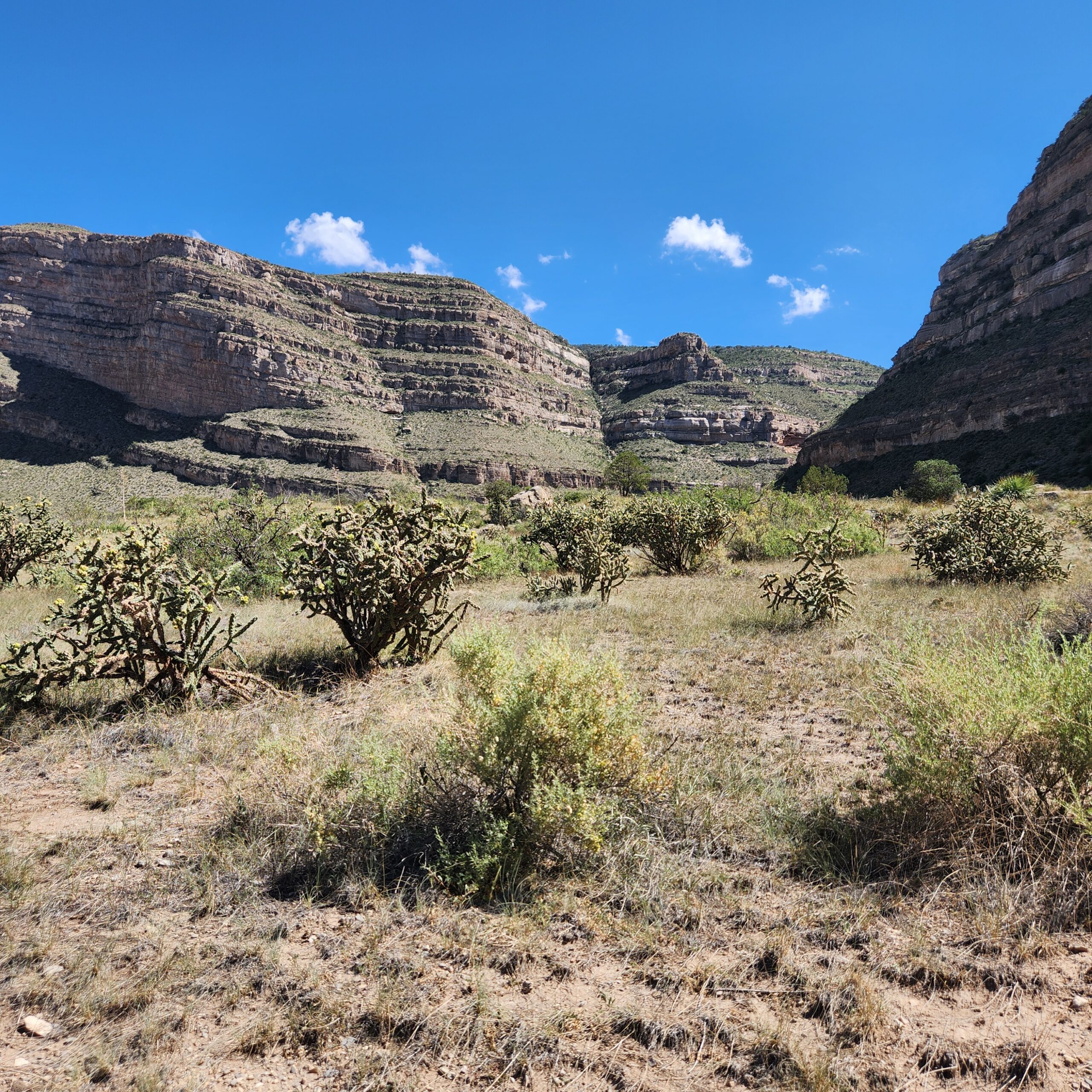
About a mile and a half in, the trail evens out to a lovely meadow, populated by cacti and century plants and desert spoons.


From here, the views of White Sands and the Tularosa Basin are incredible.

The views ahead are equally incredible. You get to take in the rugged canyon walls as you walk through 3 different meadows and a few slight ascents.


The Dog Canyon trail has extremely limited shade. So when we saw a fairly large tree and a rock offering some shade, we eagerly took a snack and hydration break. We must have exuded some strong smells, because we were soon swarmed with ants. My hiking buddy even had one crawl up under his shirt and bite him in several places. We swatted ants off us and continued hiking, but the sensation of ants crawling on us continued for the next mile. We couldn’t tell if the sensation was real or imagined. IYKYK.

The trail eventually starts to descend around the 3-mile mark. It dips into a shady arroyo that eventually runs into the waterfalls and depth of the canyon below.

Eventually we reached an oasis. It even contained a little pool of water and some horsetail plants, which are a rare sight in New Mexico. We don’t have a lot of water bodies here, so it always excites us to find one, even if it is a mere puddle or a trickle!


The lineman’s cabin is now crumbled stone walls surrounding a rusted bed frame. Cowboys used to sleep here after driving cattle up to this area to graze. The cabin may not have been the fanciest accommodations back then, but now I just want to camp here. A firepit in the vicinity suggests that many others have shared that sentiment. The surrounding area offered cattle and sheep a lush grazing experience they could not have lower in the Tularosa Basin.

Near the cabin is a large boulder, upon which we relaxed as we enjoyed electrolyte drinks and snacks. Ants scurried all over the rock. Given our earlier experience, we were now wary. But the ocean sound of the breeze and the exertion of the ascent helped us relax in the shade without mishap.

From here, the trail ascends to the “eyebrow,” an extremely narrow and treacherous area. One misstep and you can fall 400 feet into sharp rocks and a painful death. The Dog Canyon trail continues on for another couple miles and ends at Westside Road, or Forest Road 90, a Forest Service road that runs along the edge of the Sacramento mountains. My companion had a bad ankle and didn’t want to risk the eyebrow, so we decided to turn back.
When we felt ready, we commenced the return trip. By then, it was noon, and the September sun was hot. There is no shade on this trail, except at the lineman’s cabin, so we were grateful for the large amount of water we had packed.

The cacti along the way had opened their flowers by now. They had not been open on our ascent. The neon purple and pink flowers almost looked fake because they are such an unnatural, vibrant color. Hummingbirds and butterflies could not resist them.


We also admired the many rocks we observed on the hike. Many Dog Canyon rocks contain fossils from ancient life that once flourished in the shallow and warm Permian Sea. This sea covered southern New Mexico during the Paleozoic era, before draining into tropical lowlands and eventually becoming the desert of today. At some point millions of years ago, a dome in the sea floor collapsed, creating the Tularosa Basin. The highlands around the dome are now the Sacramento mountains and their foothills, the San Andres, and the Organs. Limestone and gypsum are some of the minerals left behind by the sea, which contain snapshots of this area’s unexpectedly wet past.


Many of the rocks also contained what appeared to be black tourmaline, or schorl. On a different hike at the bottom of Dog Canyon, which is a separate trail from this one, I found some black tourmaline crystals lying on their own. On this hike, however, they mostly appeared to be embedded in rock.


We eventually reached the edge of the cliff, where the trail sharply descends the cliff face into Oliver Lee State Park. The sound of the wind whipping the rocks directly below us was a bit anxiety-inducing. We had to fight the force of the wind as we made our way down.
My toenails ached by the time we reached the Oliver Lee visitor’s center because the descent is pretty rough. My face was red and tight from sunburn. I forgot my sun block! Big mistake.
The cars were super hot from sitting in the sun so they didn’t offer much relief. It felt good to get the AC blasting and head home for some fresh iced sun tea with mint from my garden!
Overall, this is a great hike, offering a fair cardio challenge and an incredible desert experience. I highly recommend. I will post again if I make it to Westside Road!